
software

We were approached by Utility Support solution (USS) to provide a peice of software that could enable them to manage the complicated planning process involved in organising the reinstatement of road surfaces left open by groundworks carried out by Northern Gas Networks amongst other clients.
The system consists of a SQL Server Database with an office based front end and a web portal for access from the teams in the field.
The system automatically translates (often inconsistent) data from the client and imports seamlessly into the database and calculates geolocations based on address details. This information is then used to display and colour code the jobs on Google Maps and give a real-time status screen of work.
It takes information from the field, entered on smart phones by teams on the road, and instantly updates the central database to provide an accurate snapshot of current work status around the region.
It automatically prioritises work, calculates quantities of materials, integrates with their existing route planning software and tracks performance.
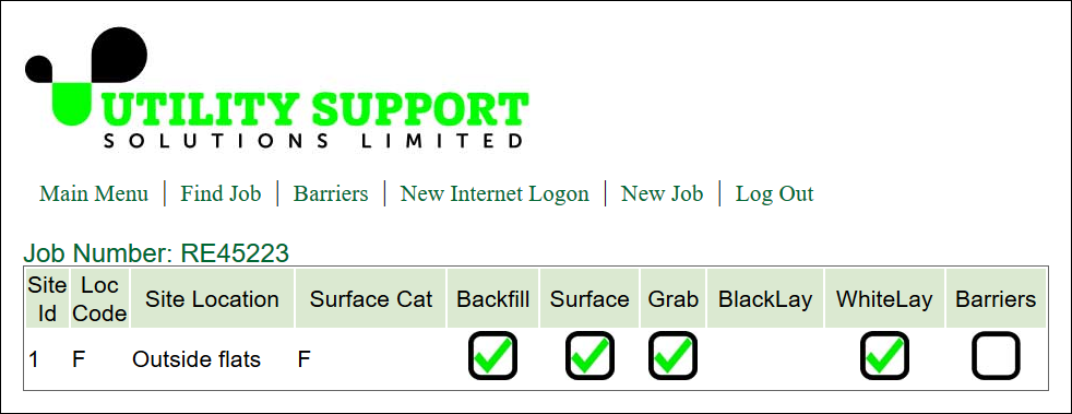
Fig1. On-line Job Status Screen
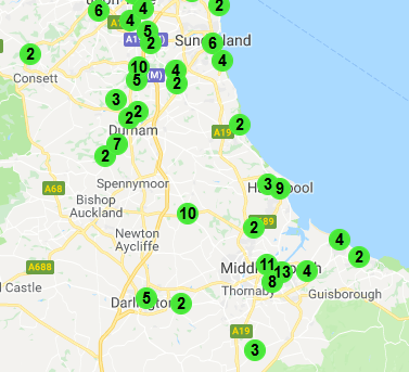
Fig2. Jobs Mapped to Google Maps
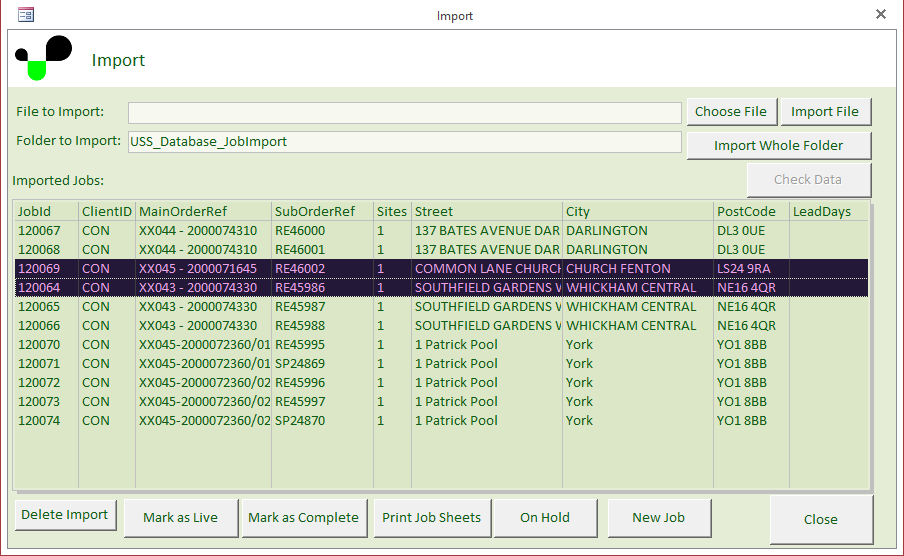
Fig3. Job Import Screen